![](/images/other/stat-length.png)
![Tocht Te voet Ingelheim am Rhein - Weinmeile - Photo](https://media.geolcdn.com/t/1900/400/4accd213-898c-47e0-aedf-5ca5e51d22f5.jpeg&format=pjpeg&maxdim=2)
Weinmeile
SityTrail - itinéraires balisés pédestres
Tous les sentiers balisés d’Europe GUIDE+
![Lengte](/images/other/stat-length.png)
![Max. hoogte](https://static1.geolcdn.com/siteimages/upload/files/1508320355ic_sort_altitude_max_24dp.png)
![Positief hoogteverschil](https://static1.geolcdn.com/siteimages/upload/files/1508320355ic_sort_den_pos_24dp.png)
![Km-Effort](/images/other/stat-length.png)
![Min. hoogte](https://static1.geolcdn.com/siteimages/upload/files/1508320355ic_sort_altitude_min_24dp.png)
![Negatief hoogteverschil](https://static1.geolcdn.com/siteimages/upload/files/1508320355ic_sort_den_neg_24dp.png)
![Boucle](https://static1.geolcdn.com/siteimages/upload/files/16400158638029165_repeat_loop_refresh_sync_direction_icon.png)
![Te voet](https://static1.geolcdn.com/sitytour/trail-icons/100.png)
56m
Moeilijkheid : Gemakkelijk
![Scan deze QR-code om de tocht te openen in de SityTrail-applicatie](https://capi.geolives.com/qq0zvz2zws4bq2lad0pu/sitytour/trails/3099080/qr.png?size=200)
Gratisgps-wandelapplicatie
Over ons
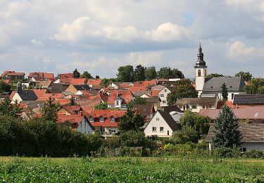
Tocht Te voet van 3 km beschikbaar op Rijnland-Palts, Landkreis Mainz-Bingen, Ingelheim am Rhein. Deze tocht wordt voorgesteld door SityTrail - itinéraires balisés pédestres.
Beschrijving
Symbol: grünes Irgendwas mit rechtsseitig im Dreieck, Spitze nach links, angeordneten 6 roten Tupfen, vermutlich rote Trauben über grünem Weinblatt.
Plaatsbepaling
Opmerkingen
Wandeltochten in de omgeving
![Tocht Te voet Ingelheim am Rhein - Kaiserpfalzweg - Photo](https://media.geolcdn.com/t/375/260/fce84757-c52f-41cd-87c3-4d4da52e38d6.jpeg&format=jpg&maxdim=2)
![Te voet Te voet](https://static1.geolcdn.com/sitytour/trail-icons/100.png)
Te voet
![](/images/other/stat-length.png)
![](https://static1.geolcdn.com/siteimages/upload/files/16400158638029165_repeat_loop_refresh_sync_direction_icon.png)
![Tocht Te voet Gau-Algesheim - Gau-Algesheim: Rundweg Rabenschule - Photo](https://media.geolcdn.com/t/375/260/ca85e123-7982-43a9-a7b9-cf5438cdde51.jpeg&format=jpg&maxdim=2)
![Te voet Te voet](https://static1.geolcdn.com/sitytour/trail-icons/100.png)
Te voet
![](/images/other/stat-length.png)
![](https://static1.geolcdn.com/siteimages/upload/files/16400158638029165_repeat_loop_refresh_sync_direction_icon.png)
![Tocht Te voet Appenheim - Appenheim: 7-Quellenweg - Photo](https://media.geolcdn.com/t/375/260/ea6e14d4-4768-4e66-812e-25c56d02cbc0.jpeg&format=jpg&maxdim=2)
![Te voet Te voet](https://static1.geolcdn.com/sitytour/trail-icons/100.png)
Te voet
![](/images/other/stat-length.png)
![](https://static1.geolcdn.com/siteimages/upload/files/16400158638029165_repeat_loop_refresh_sync_direction_icon.png)
![Tocht Te voet Ingelheim am Rhein - Wanderweg Mainzer Berg - Photo](https://media.geolcdn.com/t/375/260/b2dea8bf-12a6-4c90-89f4-3306a67cdad5.jpeg&format=jpg&maxdim=2)
![Te voet Te voet](https://static1.geolcdn.com/sitytour/trail-icons/100.png)
Te voet
![](/images/other/stat-length.png)
![](https://static1.geolcdn.com/siteimages/upload/files/16400158638029165_repeat_loop_refresh_sync_direction_icon.png)
![Tocht Te voet Ingelheim am Rhein - Panoramaweg - Photo](https://media.geolcdn.com/t/375/260/b2dea8bf-12a6-4c90-89f4-3306a67cdad5.jpeg&format=jpg&maxdim=2)
![Te voet Te voet](https://static1.geolcdn.com/sitytour/trail-icons/100.png)
Te voet
![](/images/other/stat-length.png)
![](https://static1.geolcdn.com/siteimages/upload/files/16400158638029165_repeat_loop_refresh_sync_direction_icon.png)
![Tocht Te voet Appenheim - Appenheim: Panoramaweg - Photo](https://media.geolcdn.com/t/375/260/454466a3-386a-45d7-a5e7-da121bcbe225.jpeg&format=jpg&maxdim=2)
![Te voet Te voet](https://static1.geolcdn.com/sitytour/trail-icons/100.png)
Te voet
![](/images/other/stat-length.png)
![](https://static1.geolcdn.com/siteimages/upload/files/16400158638029165_repeat_loop_refresh_sync_direction_icon.png)
![Tocht Te voet Gau-Algesheim - Gau-Algesheim: Dreibächeweg - Photo](https://media.geolcdn.com/t/375/260/9443a4b9-c146-4f82-b83a-f1fe6729c76f.jpeg&format=jpg&maxdim=2)
![Te voet Te voet](https://static1.geolcdn.com/sitytour/trail-icons/100.png)
Te voet
![](/images/other/stat-length.png)
![](https://static1.geolcdn.com/siteimages/upload/files/16400158638029165_repeat_loop_refresh_sync_direction_icon.png)
![Tocht Te voet Ingelheim am Rhein - Rundweg Westerberg - Photo](https://media.geolcdn.com/t/375/260/786eed27-c210-4f7d-b7c8-50423b81f5c7.jpeg&format=jpg&maxdim=2)
![Te voet Te voet](https://static1.geolcdn.com/sitytour/trail-icons/100.png)
Te voet
![](/images/other/stat-length.png)
![](https://static1.geolcdn.com/siteimages/upload/files/16400158638029165_repeat_loop_refresh_sync_direction_icon.png)
![Tocht Te voet Ingelheim am Rhein - Hiwweltour Bismarckturm Zuweg - Photo](https://media.geolcdn.com/t/375/260/7d26eb2e-c4bc-43e7-a3d9-4578adcc9342.jpeg&format=jpg&maxdim=2)
![Te voet Te voet](https://static1.geolcdn.com/sitytour/trail-icons/100.png)
Te voet
![](/images/other/stat-length.png)
![](https://static1.geolcdn.com/siteimages/upload/files/16400158638029165_repeat_loop_refresh_sync_direction_icon.png)